

Piton de la Petite Rivière Noire (Black River Peak)
The highest point in Mauritius is earned over 6.4 km round trip, in the shade of the native forest — and it is far more accessible than most people think.
Is the highest point a hard climb?
Less than you would imagine. The trail starts high already, on the plateau at around 680 metres: only some 150 metres of climbing remain to the 828-metre summit. What makes the outing demanding is not the gradient but the ground — roots, mud that lingers long after rain, and a few fixed ropes over the final metres. Allow 3 to 4 hours round trip for 6.4 km, with no guide and no entrance fee, the trail being clearly marked with paint on the rocks.
The route
The path first plunges into the national park forest, on a steady, shaded trail. It is a detail that changes everything and that most guides miss: the route is in shade for almost 4 km, with only the last two hundred metres out in full sun. You therefore hike in the cool, which is rare in Mauritius.
The forest is made of the native species the park protects: ebony trees, bois de natte, and above you the calls of the echo parakeet, that parrot pulled back from the brink of extinction. The trail climbs in steps, crosses a few muddy stretches that never truly dry, then steepens for the final push where fixed ropes help on the rock.
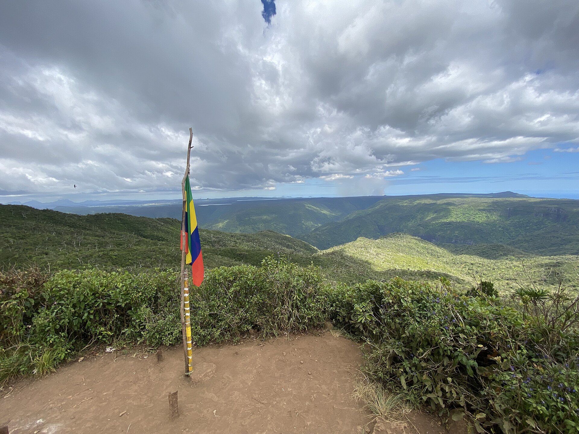
At the summit the reward is complete: the entire west coast opens below, from Le Morne to Flic en Flac, with the gorges dropping away on one side and the lagoon on the other.
Access and parking
The trailhead lies along the B103 road, on the plateau: coordinates -20.42336 / 57.42628. Parking is the real weak point — only two or three cars fit at the start. Arrive early or be prepared to walk in from some distance. One more warning: an incorrect coordinate circulates on some encyclopaedic entries, several kilometres too far east and incompatible with the actual trail.
Free and open access. The trail belongs to the Black River Gorges national park network, whose gates close at 5pm: bear that in mind if you link up with other park trails.
When to go
May to November for preference. Mud is the deciding factor: after several days of rain the trail becomes an ice rink in places and the final ropes are markedly less pleasant. In the dry season the outing is genuinely enjoyable, all the more so as the shade keeps the heat at bay.
⚠️ The costly mistake: turning up in street trainers after rain. The elevation gain is modest but the ground is greasy and root-covered along almost the whole route: this is the island's most slippery hike, and a twisted ankle halfway into a national park ends badly.
Around the hike
The summit belongs to Black River Gorges national park, over 6,500 hectares and the largest trail network on the island — enough to follow up with the Macchabée trail or the gorges viewpoints the next day. Black River village, its shops and the lagoon are a quarter of an hour downhill.
Read more
Frequently asked questions
What is the highest mountain in Mauritius?
Piton de la Petite Rivière Noire, also called Black River Peak, at 828 metres, in Black River Gorges national park. Then come Pieter Both (820 m) and Le Pouce (812 m).
How long does it take to climb Black River Peak?
3 to 4 hours round trip for 6.4 km. The actual elevation gain is modest, around 150 metres, because the trail starts at 680 metres.
Do you need a guide for the highest point of Mauritius?
No. The trail is clearly marked and access is free. Good shoes are essential, however, as the ground is often muddy.