


Mauritius Guide › Hiking › La Tourelle de Tamarin
La Tourelle de Tamarin
563 metres above Tamarin bay, a relentless climb and fixed ropes: the hike you do before breakfast when you live on the west coast.
Hike · Tamarin · 563 m
A small mountain, a real hike
The modest altitude is misleading. The path climbs 560 metres over 4.4 km round trip, which means a sustained gradient almost throughout, with sections fitted with ropes. Allow 2 h 30 to 4 hours depending on your pace.
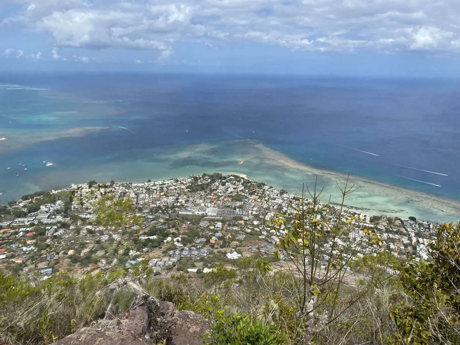
This is not a beginner's hike, but it is one of the most rewarding on the island: the summit looks straight down onto the lagoon.
One point often left unsaid: part of the route crosses private land. Local practice is to ask the owner's permission. The path is also unmarked, which makes company useful on a first attempt.
In this guide
The route
From sea level to 563 metres almost in one go, with fixed ropes on the rock steps.
The start
From the coast road between Tamarin and La Preneuse. The peak rises less than a kilometre from the shore, which explains the steepness.
The dry scrub
The climb alternates faint paths through dry vegetation and the first rock steps. The gradient barely relents.
The fixed ropes
Ropes help on the rock steps. Nothing technical in the climbing sense, but you need arms and shoes that grip.
The summit
Tamarin bay laid out below, the Black River lagoon, Le Morne to the south, and opposite the silhouettes of Rempart and Corps de Garde. At sunset, one of the finest viewpoints in Mauritius.
Access and parking
Getting to the trailhead
The path leaves the B9 coast road between Tamarin and La Preneuse. There is no ticket office and no official hours, but access crosses private property. A local guide settles that question along with the route itself.
See the trailhead →Parking
Roadside parking on the coast road. As the path is unmarked, company is useful on a first outing.
When to go
Best season
All year — the austral winter gives the best visibility over the lagoon.
Best time of day
Early or late — the slope is very exposed and the midday heat is harsh.
Avoid
After rain — the ropes and rock become slippery.
What else to do around La Tourelle
Frequently asked questions
Frequently asked questions
Harder than it looks: 560 metres of ascent over 4.4 km round trip, with rope-fitted sections. Allow 2 h 30 to 4 hours and reasonable fitness.
Part of the route crosses private land and local practice is to ask the owner. As the path is unmarked, a local guide settles both questions at once.
563 metres, less than a kilometre from the shore, which explains how steep the climb is.
Yes, and it is one of the island's finest viewpoints at that hour — provided you carry a head torch: night falls in twenty minutes and the descent includes rope sections.
Sources and checks
Checked on 2 September 2026. Opening times, fees and access conditions change: confirm them before you set off.
Your project in Mauritius
Thinking of moving to Mauritius?
Westimmo does more than help you find a property. We help you understand the regions, choose where to live and prepare your move to Mauritius.
Talk to us about your project