


Mauritius Guide › Hiking › Le Morne Brabant
Le Morne Brabant
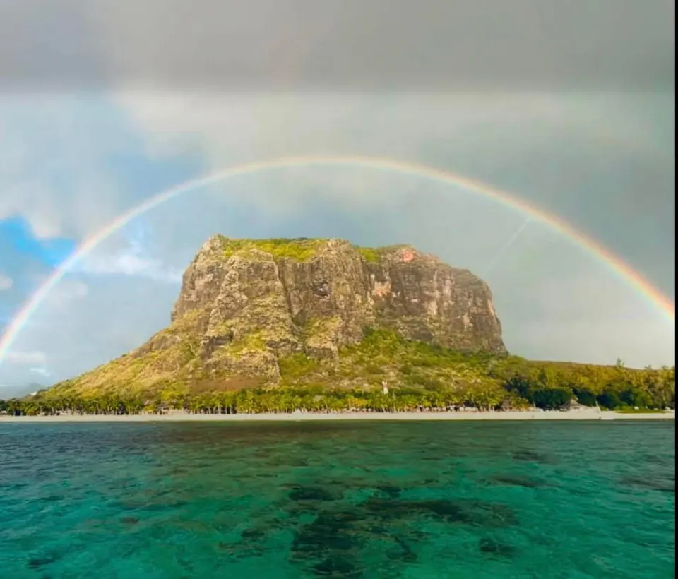
556 m above the lagoon, 3 to 5 hours round trip and a final section climbed on all fours: everything you need to know before setting off.
Hike · South-West Coast · UNESCO
Do you need a guide, and how hard is it?
No, a guide is not compulsory: access is free and open to all. This is the single most poorly relayed piece of information about the mountain, and older articles still claim the opposite.
That said, the hike has to be earned. The first half, up to the plateau, is a wide and steady walk that most people manage without difficulty. The second is another matter: the rock is climbed hands and feet, a few fixed ropes help on the steepest sections, and there is exposure.
If you are not comfortable on mountain terrain, take a guide for that part — expect Rs 1,000 to 1,500 per person. Be aware too that the wardens may close the upper section in wet weather: the rock becomes genuinely slippery.
In this guide
The route
A wide track to the plateau, then a rock section that changes the nature of the outing entirely.
The western track
From the gate, a wide track rises gently through dry vegetation. You gain height almost without noticing.
The middle plateau
After some forty minutes the lagoon appears below, with Île aux Bénitiers in the distance. A natural turning point for many: the view is already superb and the ground is safe.
The rock section
Beyond, the terrain changes. The path steepens, rock replaces earth and hands come into play. It is graded as a demanding alpine hike — short, but it calls for confidence.
The summit cross
It opens onto the view that made the place famous: the lagoon in bands of turquoise, and the optical illusion of an “underwater waterfall” formed by the sandbanks offshore.
Access and parking
Getting to the trailhead
The trailhead sits at the end of the road along the peninsula, on the western side, at a gate. Car park coordinates: -20.46001 / 57.32728. The gate opens at 7 am and closes at 4 pm, with the last ascent around 2.30 pm. In a cyclone or heavy rain the site closes outright.
See the trailhead →Parking
Entry is free. Parking is at the foot of the trail; the site is managed, you are not left to your own devices.
When to go
Best season
May to November — the austral winter brings dry air, 20 to 25 °C and stable rock. September to November is the perfect window.
Best time of day
Early morning — in summer, set off at dawn; the last ascent closes at 2.30 pm.
Avoid
After a downpour — skip the upper section: that is precisely where accidents happen.
What else to do around Le Morne
Frequently asked questions
Frequently asked questions
Allow 3 to 5 hours round trip for about 7 km and 540 m of ascent. Up to the middle plateau only, a relaxed half day is enough.
Yes, access is free and open. A guide is still recommended for the summit section, which is rocky and exposed, especially if you are not used to mountain terrain.
Up to the end of the plateau, about 2.3 km from the start, yes. Beyond that children are not permitted: the section is too technical and exposed.
The gate opens at 7 am and closes at 4 pm, with the last ascent to the summit allowed around 2.30 pm. The site closes in bad weather.
Sources and checks
Checked on 2 September 2026. Opening times, fees and access conditions change: confirm them before you set off.
Your project in Mauritius
Thinking of moving to Mauritius?
Westimmo does more than help you find a property. We help you understand the regions, choose where to live and prepare your move to Mauritius.
Talk to us about your project