


Mauritius Guide › Hiking › Trois Mamelles
Trois Mamelles
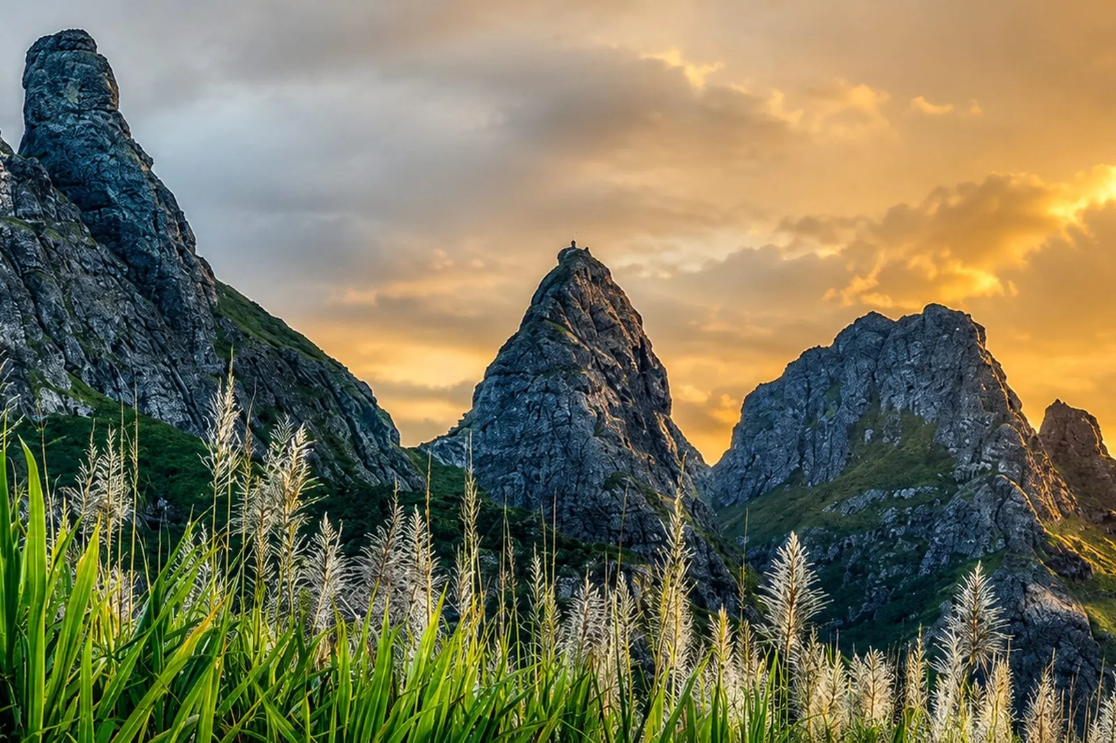
Four and a half kilometres, 291 metres of ascent and a rope on the final stretch: the most recognisable three-peaked skyline on the island.
Hike · Plaines Wilhems · 578 m
How hard are the Trois Mamelles?
The mountain is short, and that is exactly what misleads people. The GPS track gives 4.5 kilometres round trip for 291 metres of ascent and 2 h 15 of outing, with a high point recorded at 578 metres. Modest figures, for ground that is anything but.
Hikers who have logged the route describe scrambling in places, and a rope to hold on the last twenty metres, above the drop. Several turn back before that section — a sensible choice, not a failure.
The path is unmarked and crosses wooded ground where navigation needs attention. Downloading a track beforehand saves a lot of guesswork in the early sections.
In this guide
The route
A wooded approach, a genuinely technical climb, then a saddle from which the view reaches both sides of the island.
The start
You park before the roundabout, on the Solférino side, below a roadside sign. The path first drops into the woods.
The approach
The early sections cross dense vegetation where insects are plentiful in the wet season. The line is not obvious: this is where the GPS track earns its keep.
The climb
The gradient turns steep and technical. Hands are as useful as feet up to the saddle that separates the peaks.
The final step
The last twenty metres towards the central peak are narrow and exposed, with a rope in place. Stopping at the saddle still makes a fine outing.
Access and parking
Getting to the trailhead
The start is taken on the Solférino side, before the roundabout, with roadside parking identifiable by a sign.
See the trailhead →Parking
A few roadside spaces, with no facilities. As the path is unmarked, bring a GPS track before committing.
When to go
Best season
May to November — the austral winter gives the driest rock and the best visibility.
Best time of day
Morning — so as to finish the technical part before the heat and the showers set in.
Avoid
Any wet weather — the rock turns slippery and the final step becomes genuinely risky.
What else to do around Trois Mamelles
Frequently asked questions
Frequently asked questions
Yes. Despite a short distance of 4.5 km, the ground is technical: several sections where you use your hands, and a rope in place on the last twenty metres.
It is recommended. The path is unmarked and the final step calls for confidence on rock.
About 2 h 15 round trip for 4.5 km and 291 metres of ascent, according to GPS tracks.
Yes, and many do. The saddle between the peaks already gives the view on both sides of the island, without the exposed section.
Sources and checks
Checked on 2 September 2026. Opening times, fees and access conditions change: confirm them before you set off.
Your project in Mauritius
Thinking of moving to Mauritius?
Westimmo does more than help you find a property. We help you understand the regions, choose where to live and prepare your move to Mauritius.
Talk to us about your project